Who we are
Oromocto River Watershed
About Us
Oromocto River Watershed


The Oromocto River Watershed Association Inc. (ORWAI) is a non-profit organization committed to the improvement of the Oromocto River Watershed.
Charitable Non Profit Registration #857090328RR0001
Our Mission Statement
Vision
Meet our
Board of Directors
Our dedicated Board of Directors brings together a diverse group of individuals committed to preserving and enhancing the Oromocto River Watershed. With expertise spanning science, community engagement, and environmental stewardship, their leadership guides our mission to protect this unique ecosystem for generations to come. Learn more about the passionate people working behind the scenes to support our watershed and its communities.

Robin Hanson
President
Tegan Noble
Vice-President
Aaron Fraser
Science
Other Board Members
Jack Carr, Director
Andy Smith, Director
Wayne Baker, Director
Russell Ferris, Director
Gail Gardner, Director
Tom Lutz, Director
David Olive, Director
Diane Wood, Sect/Treasurer
What is a
Watershed?
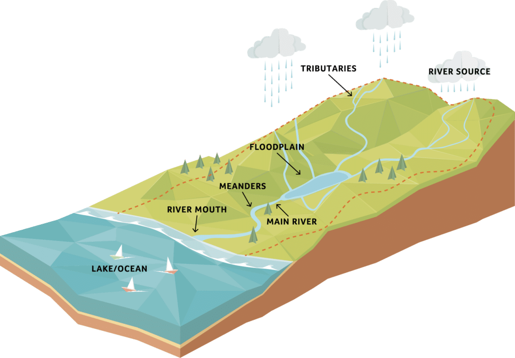
“Water runs downhill” and a watershed is a land area whose runoff drains into any stream, river, lake and ocean. All land is part of a watershed and we all live in a watershed.
We, as humans along with plant and animal life depend on the watershed and influence it in some way.As water flows downhill in small to progressively larger streams and rivers, it moves over land and provides water for urban, agricultural and environmental needs. The watershed community is made up of everyone who lives there plus all other plant and animal life.
A watershed collects water from rainfall, it stores water of various amounts, it releases water as runoff, it provides diverse sites for chemical reactions to take place and it also provides habitat for floral and fauna.
Human activities affect all of the functions of a watershed. It is up to us to improve and protect our watersheds for the generations to come.
2040 SQ/Kms
The Geography of the
Oromocto River Watershed
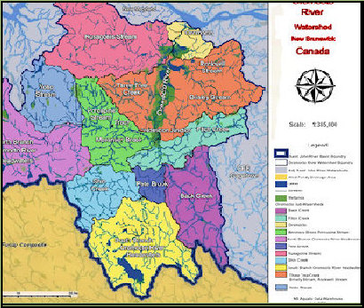
The Oromocto River Watershed is nearly 1/2 the size of Prince Edward Island and occupies space in four counties, Sunbury, York, Charlotte and Queens. It is located in Southwestern New Brunswick, Canada.
The drainage area is 2040 square kilometers. This includes the Town of Oromocto and the communities of Lincoln, Rusagonis, Waasis, Waterville, Haneytown, Base Gagetown, Geary, French Lake, Hanwell, Nasonworth, Charters Settlement, New Maryland, Beaverdam, Tracy, Yoho Lake, Little Lake Road, Cork Station, Harts, Harvey, Tweedside, Blissville, Hoyt, Patterson, Wirral, Enniskillen, Mill Settlement, Juvenile Settlement, Sand Brook, Back Clarendon, North Oromocto Lake and South Oromocto Lake.
The top of the watershed consists of North Oromocto Lake and South Oromocto Lake. These large lakes are crystal clear and average about 7 meters in depth. North Oromocto Lake (13km x 4.5km) is near Harvey N.B. The North Branch (45km) flows east northeast through the villages of Tracy and Fredericton Junction. South Oromocto Lake is 7 km long and 2 km wide. The South Branch is 39 km long and flows north-northeast through the communities of Hoyt and Central Blissville. The two branches join near Central Blissville and flow 42 km north-northeast to its mouth at the Saint John River by the Town of Oromocto.
Both branches (North and South) are fast running with many tributaries. The main Oromocto becomes tidal in low water for approximately 40 km to its mouth. This tidal area forms a calm, flat basin containing many streams, lakes and ponds.
The early spring freshet adds 6 meters to the depth over summer and creates a flood plane reservoir of approximately 45 km by 3 km.
